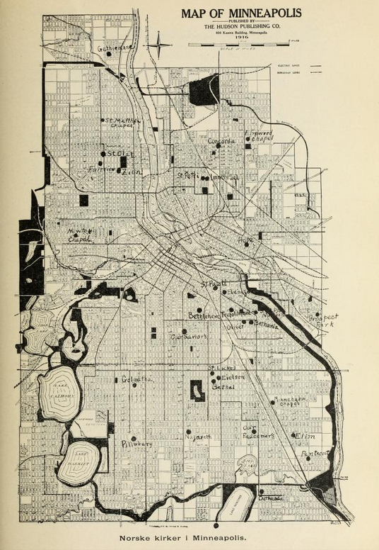

Minneapolis (Hennepin County) Congregations.
Norlie provides a map of several Minneapolis congregations. Our attempt to map all Hennepin County congregations highlighted the mismatch between his location data and the demands of contemporary mapping engines for precise addresses. Additional research in various sources can provide those, but with much effort.
The story map in the project for Trinity (Minneapolis) shows that congregation’s several locations as well as a single location for each of its daughters. That information is displayed here on a contemporary street map.
Next steps . . . add more congregations to this map . . . use data from Trinity’s 1918 anniversary booklet to map the addresses of its members taking note of their proximity to the church and to transit lines.