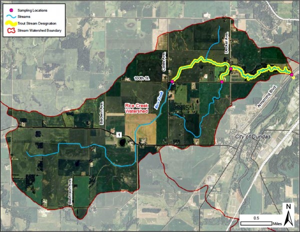
Known by one of two names – Rice Creek or Spring Brook – this cold water stream (HUC 07040002-557) is the only designated trout stream in Rice County, Minnesota. Unlike the neighboring warm water streams of Health Creek and Wolf Creek, Rice Creek emerges from significant shallow groundwater inputs giving it colder temperatures; consequently, its waters host a naturally reproducing population of brook trout (Savelinus fontinalis). For the last few decades local community members have been concerned about the fate of this unique ecosystem, as the area faces different pressures: gravel mining, ground water withdrawl, listing on the Minnesota 303(d) Impaired Waters List, and changes in land use or land management. While the entire watershed is small (4400 acres) and largely agricultural, the lower reach of the stream straddles both the urban expansion boundaries of Northfield and Dundas! In partnership with local units of government (Bridgewater Township, City of Northfield), non-governmental organizations (Cannon River Watershed Partnership, Trout Unlimited), and area residents, we collaborate to seek answers to the following questions.
What is the current ecological, chemical, and physical state or condition of the watershed and how do they compare to the 2010-2013 baseline values?
With agriculture as the dominant land use, how can we develop partnerships with land owners and ag practitioners to make strategic targets for change?
What wise policy decisions and best practices, including possible development, land use change, or land management change, will lead to improvements in the ecosystem functions of the watershed?
How can we know what continues to happen on this landscape as people implement various policies and practices, such as no-till and cover crops?
Timeline:
2010-13 Baseline data collection across watershed (biological, chemical, physical and historical). Report & Implementation plan
2011-16 Data integrated into Cannon River Watershed decadal assessment and WRAPS
2018-21 Fishers & Farmers Partnership award expands cover crop coverage to >30% tillable acres. YouTube
2021-23 Fishers & Farmers Partnership award expands cover crops to adjacent watersheds