Rationale
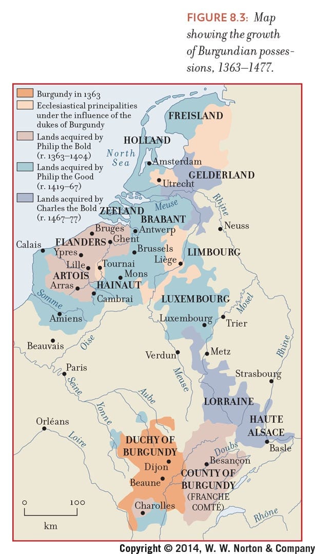
The first map offers a chronological account of the spread of Burgundian influence over what would later become France and the Low Countries. Students need to know about the spread of Burgundian influence and the connections the Burgundian court fostered among composers to understand how musicians accessed and spread new styles and practices throughout the 14th and 15th centuries.
The second map shows European political boundaries around 1500, helping students see why Spanish genres like the villancico could influence Italian court musicians and paving the way for an understanding of the French court of Louis XIV as one of increasingly centralized, authoritarian power.
Both maps provide important context for understanding how musical styles and practices developed over time and space. Neither, however, directly relates place to sound, or offers any opportunity for students to see the relationship between chronology and music that constitutes a primary object of musicological study, particularly at the undergraduate level.
To butcher Bernard Le Bovier de Fontenelle (see https://www.jstor.org/stable/40374475?seq=1#page_scan_tab_contents): Maps, what should we want of you? And we would answer: Quite a lot more than we’re getting, please. Ideally, music historical maps would satisfy the following conditions:
1) Maps should be interactive. Burgundian influence spread through alliances, marriages, and conquest – none of which quite comes across in the static presentation above. Elementary school students layer transparent maps on top of one another to learn the interplay of topography, political boundaries, and human activity. Why can’t scholarly and pedagogical maps allow similarly active learning opportunities?
2) Maps should be organized chronologically as well as spatially. Things change over time, but showing that on a map usually requires complicated color schemes (see above) or a series of individual maps, side by side (for more, read our methodology). Usually, mapmakers choose not to represent time at all, even in music history textbooks – making students’ (and professors’) jobs much more difficult.
While it’s possible to meet these conditions with separate paper-and-ink maps, we believe that digital maps allow more flexibility while providing more power. And with the recent proliferation of Digital Humanities research, we can rely on a substantial body of scholarship to guide our quest for a better way to map music history.
You must be logged in to post a comment.